# Display water surface with water depth colouring
**URL:** https://discourse.paraview.org/t/display-water-surface-with-water-depth-colouring/9475
**Category:** ParaView Support
**Created:** [April 20, 2022, 12:47pm UTC](https://discourse.paraview.org/t/display-water-surface-with-water-depth-colouring/9475 "2022-04-20T12:47:55Z")
**Posts on this page:** 4
**Page:** 1
### Author:  [@HorC](https://discourse.paraview.org/u/HorC)
#### Post date: [April 20, 2022, 12:47pm UTC](https://discourse.paraview.org/t/display-water-surface-with-water-depth-colouring/9475/1 "2022-04-20T12:47:55Z")
Hi everyone
**Context** :
I’m working with the BASEMENT model (www.basement.ethz.ch) to simulate environmental fluid flow.
**What I have** :
What I’m getting as output is an .xdmf file containing a) water depth information and b) water surface elevation information of the computational mesh.
**What I need** :
My goal is to visualize the 3D water surface / water level (using water surface elevation information) but with the colouring defined by the water depth.
Currently I’m only able to visualize either the water surface (but it doesn’t show the actual water level, it shows water surface projected on the grid) or water depth. Basically, in my example the sink should be completely filled and the water depth should be displayed in colour. How would this be possible?
**Data** : output\_run\_a.xdmf
[output\_run\_a.xdmf](https://discourse.paraview.org/uploads/short-url/1b1ODM2yxzAjLdlsSlkATYfnYfo.xdmf) (2.7 MB)
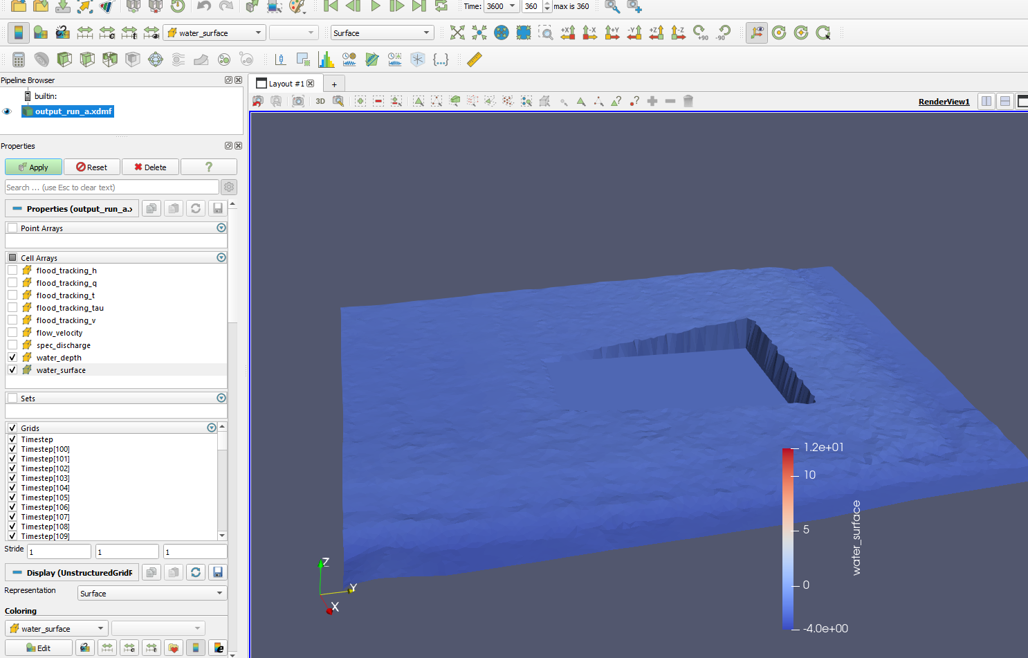

Any help is much appreciated, I’d be really glad if I could solve this!
Thank you very much and have a good day everyone
Christoph
---
### Author:  [@HorC](https://discourse.paraview.org/u/HorC)
#### Post date: [April 25, 2022, 7:11am UTC](https://discourse.paraview.org/t/display-water-surface-with-water-depth-colouring/9475/2 "2022-04-25T07:11:12Z")
**Note** : The .xdmf is only a reference to the simulation results. All simulation results uploaded [here](https://geo7ch-my.sharepoint.com/:f:/g/personal/hoc_geo7_ch/EsOkc5s2S4NOkHLHNwAL-isBmzVncopM6aTSSSN8VpxjIQ?e=JbQWBl).
---
### Author:  [@Kenichiro-Yoshimi](https://discourse.paraview.org/u/Kenichiro-Yoshimi)
#### Post date: [April 25, 2022, 9:59am UTC](https://discourse.paraview.org/t/display-water-surface-with-water-depth-colouring/9475/3 "2022-04-25T09:59:39Z")
Is the following procedure what you are looking for?
1. **Cell Data to Point Data** filter
2. **Warp By Scalar** filter
3. Select `warp_surface` for **Scalars** in the **Warp By Scalar** filter
4. Coloring with `warp_depth`

---
### Author:  [@HorC](https://discourse.paraview.org/u/HorC)
#### Post date: [April 25, 2022, 10:55am UTC](https://discourse.paraview.org/t/display-water-surface-with-water-depth-colouring/9475/4 "2022-04-25T10:55:54Z")
This is exactly what I was looking for! Thank you so much I’m very grateful.
I actually found that in step 3 I need to choose water\_depth as warping scalar (instead of water\_surface) as this will add the water\_depth on top of the base elevation, so will properly represent the surface of the water.
Thanks again!!