# Draping a PNG image on the top face of a VTK object
**URL:** https://discourse.paraview.org/t/draping-a-png-image-on-the-top-face-of-a-vtk-object/14571
**Category:** ParaView Support
**Created:** [May 7, 2024, 9:25am UTC](https://discourse.paraview.org/t/draping-a-png-image-on-the-top-face-of-a-vtk-object/14571 "2024-05-07T09:25:41Z")
**Posts on this page:** 2
**Page:** 1
### Author:  [@Flow](https://discourse.paraview.org/u/Flow)
#### Post date: [May 7, 2024, 9:25am UTC](https://discourse.paraview.org/t/draping-a-png-image-on-the-top-face-of-a-vtk-object/14571/1 "2024-05-07T09:25:41Z")
Hello,
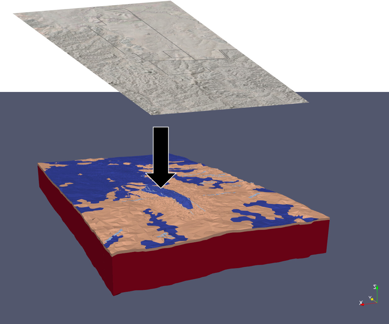
I would like to drape a satellite image (PNG format) to the top surface of a VTK object without obscuring the other sides.
I have gone through the posts below and developed a workflow using Texture Map to Plane and then load the image as texture. However, this affects all the sides of my VTK object.
Please find attached a picture illustrating what I am attempting to do - I need my other sides (i.e. the red sides in the picture) to remain visible and not be obscured by the satellite image texture.
Many thanks in advance - any advice on this matter would be greatly appreciated.
> [@Draping textures on top surface of a structured/unstructured grid (or variable elevation surface).](https://discourse.paraview.org/t/draping-textures-on-top-surface-of-a-structured-unstructured-grid-or-variable-elevation-surface/7331):
>
> Is there any way to drape/project a image (aerial photography in my case) onto the top surface of structured or unstructured grid defined by a VTK file? I have tried playing around with the “texture map to plane” filter but I’m not sure it will do what I’m looking for. The top surface of my grid has variable Z values since it represents the topography of the land surface. I’m not bothered by any stretching in the texture that would occur, I just need to have the XY referenced correctly and for t…
> [@How to overlay Google Map image onto elevation data from a vtk file](https://discourse.paraview.org/t/how-to-overlay-google-map-image-onto-elevation-data-from-a-vtk-file/3288):
>
> Hi all, I have a vtk file that contains elevation data which I am using for flooding simulations (see attached image). I would like to visualize the respective Google Map image on top of my elevation data. I tried to follow this [link](http://www.earthmodels.org/data-and-tools/topography/paraview-topography-by-texture-mapping), but it seems outdated since OpenStreetMaps no longer offers a bitmap export. I believe I will want to use Paraview’s texture capabilities, but I’m not 100% sure. Thank you in advance for your help. Best, Eric
---
### Author:  [@mwestphal](https://discourse.paraview.org/u/mwestphal)
#### Post date: [May 7, 2024, 9:49am UTC](https://discourse.paraview.org/t/draping-a-png-image-on-the-top-face-of-a-vtk-object/14571/2 "2024-05-07T09:49:13Z")
> [@Flow](#):
>
> However, this affects all the sides of my VTK object.
Then you want to extract the top layer first.