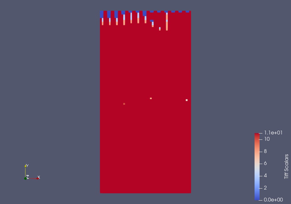
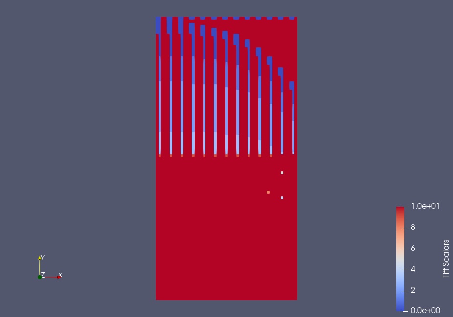
This seems to happen only when the data in the raster is highly bimodal (part of the image is close to one value and the rest is close to a different value).
soil_1.tif (5.3 KB) soil_2.tif (20.4 KB)
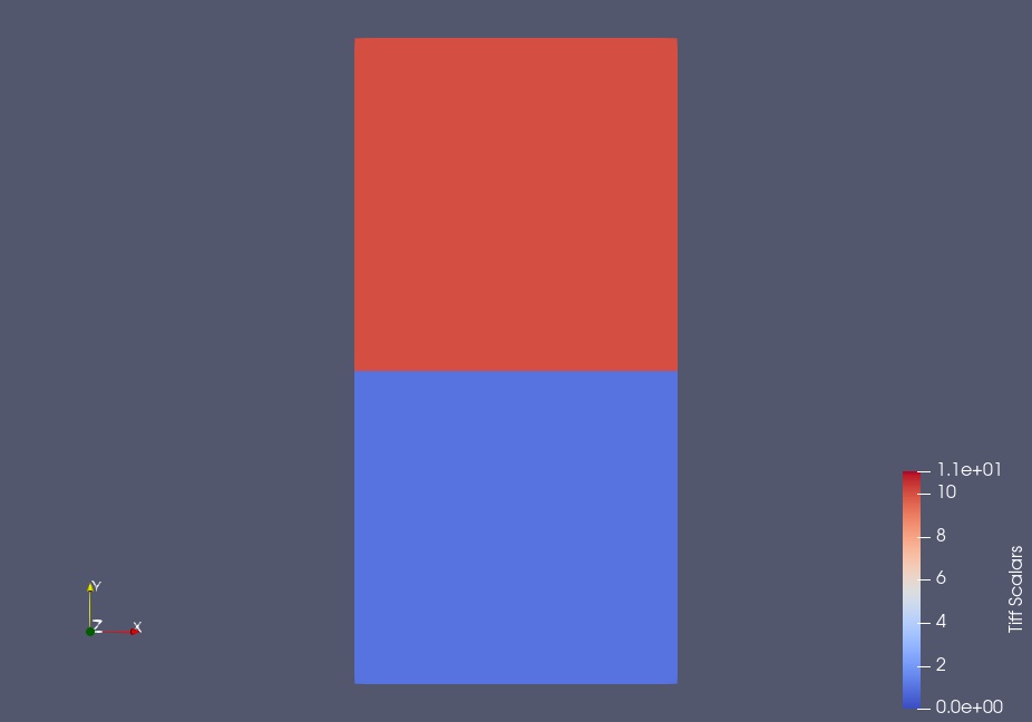
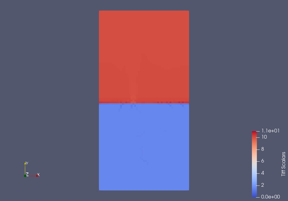
I didn’t save the exact same files but the two tif images above show the same issue. Here are the screenshots for these files loaded separately:
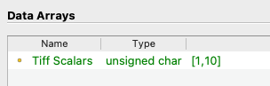
I think the problem is that your two tiff files are of different formats. If you load soil_1.tif independently, ParaView reports that the data are represented as 8-bit unsigned integer values in the Information panel.
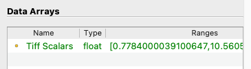
If you load soil_2.tif independently, ParaView reports that the data are represented as 32-bit floating point values.
This explains why the file size of soil_2.tif is 4 times that of soil_1.tif.
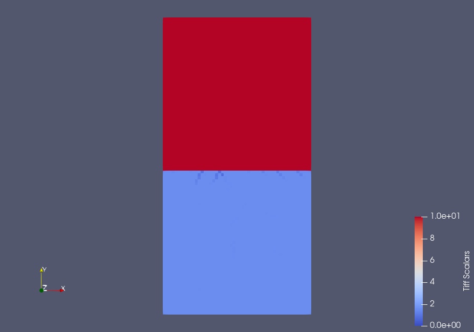
Now the problem is that when you read the files as a stack, ParaView’s tiff reader (reasonably) assumes that the data format is consistent across all the files. So, it reads the first file and identifies the data as 8-bit unsigned integers. It then assumes the second file is the same and reads the 32-float values as 8-bit integers. The weird pattern you are seeing are the 4 bits of the IEEE floating point values.
Thank you. I used a batch gdal_translate to convert the ascii xyz outputs from my mathematical model to geotiffs. I will seek out how to force gdal_translate to produce 32-bit float for all files or try another converter. That should resolve.