I have successfully imported and visualized bathymetric data for a given region of interested. I could “extrude” that (warp by scalar) so to create 3D bathyemtry and elevation.
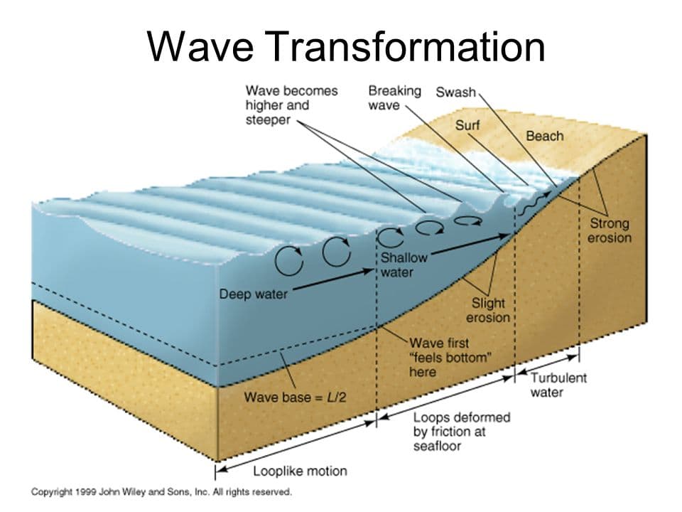
What I now want to achieve, in this is where I seem to fail, is creating a volume of water (i.e. filling my domain), so to extend, vertically, from zero level, down to each bathymetry grid point. SOmething like this figure:
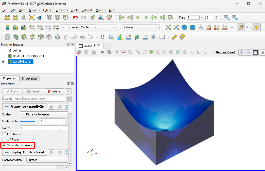
With the Nightly version of ParaView, the Warp By Scalar filter has an additional Generate Enclosure option that, when enabled, also creates the sides and bottom.
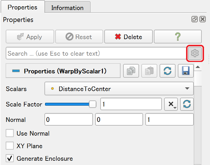
Hello there. I am trying to use this feature, but for some reason when I do Warp by Scalar I don’t have the option Generate Enclosure. Why would that be? I am working on Paraview 5.12. Thank you in advance!