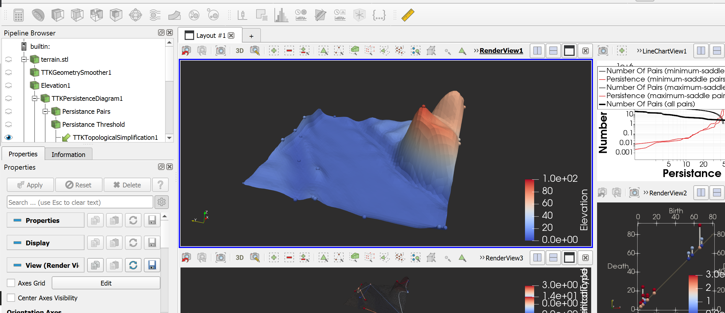
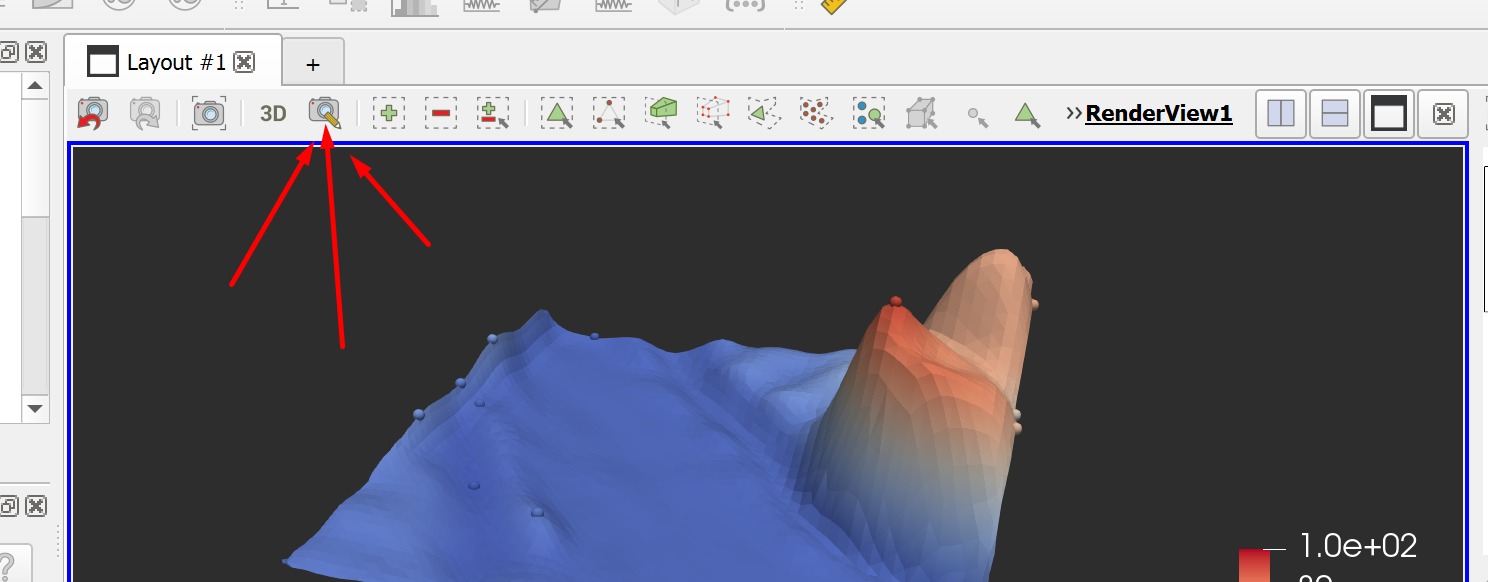
i want to find the terrain output image after simplification and putting multiple image and i will use that texture to process that texture to process !!! like satellite image of the location, i want to get the texture of mesh which mean view of mesh from the top !!
if i take a screenshot, it looks like i get screenshot of whole render view not just mesh !!
I need high resolution image ( i mean image of dimension same as dimension of the mesh) and the image that i get from screenshot looks like small image !!!