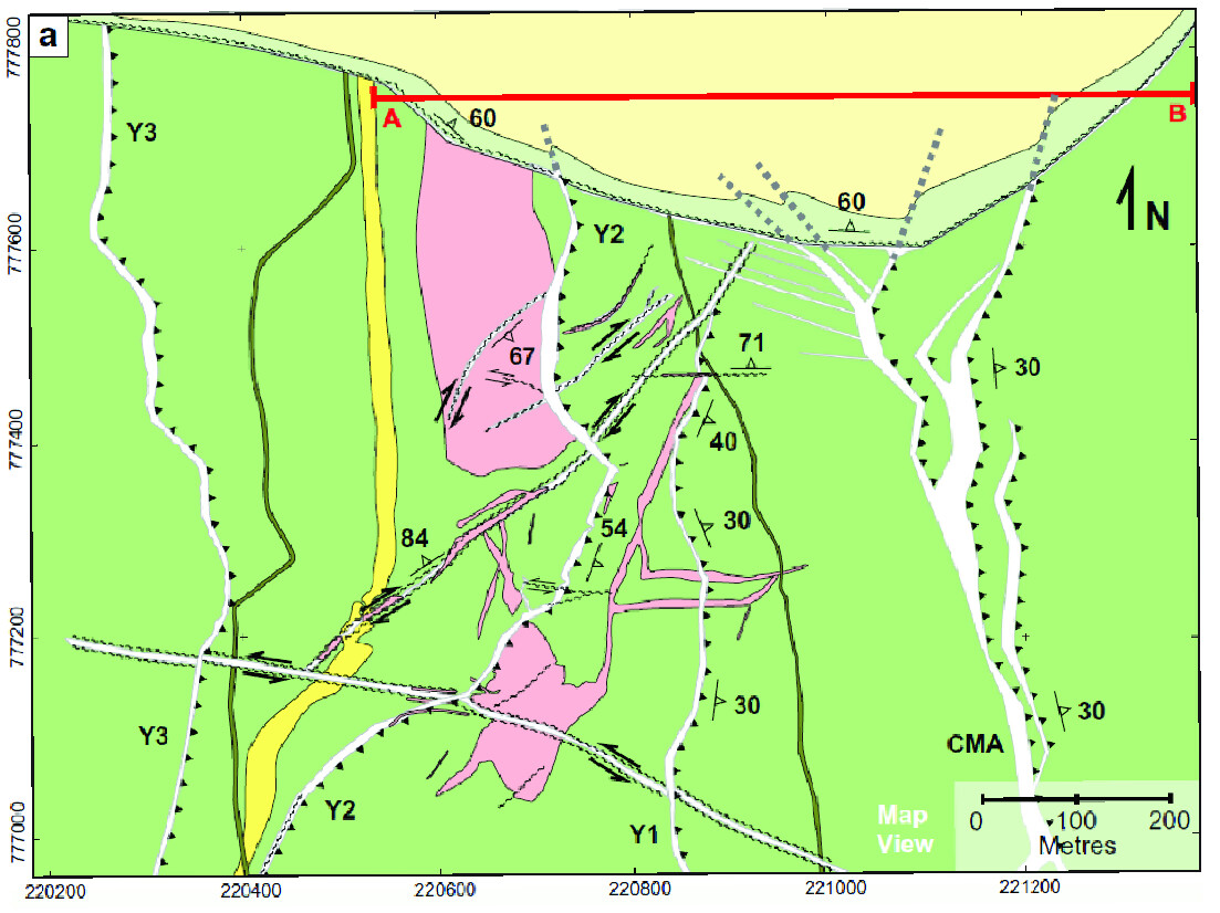
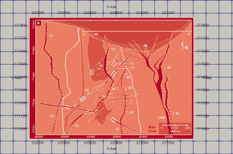
I am trying to open the following GeoTIFF in ParaView to associate the geological map with my VTK 3D mesh. However, ParaView displays the image with different red tones. Is there a way to import the GeoTIFF with the correct colors, or is there a format I can convert the GeoTIFF to (using QGIS) so it opens properly?
Hi @Vinicius , it looks to me like ParaView might be treating the RGB colors in the GeoTIFF as a vector field and mapping the magnitude of that vector to color.
To stop this mapping and show the RGB colors, go to the Properties panel and search for the Scalar Coloring section. Uncheck the box that says Map Scalars. That should hopefully do it.
If not, please share one of these GeoTIFFs if you can so someone can take a closer look.
Just sharing here (in case someone is facing the same issue): to toggle advanced properties, you need to click the button with the gear icon to the right of the search field in the Properties panel.