Hi,
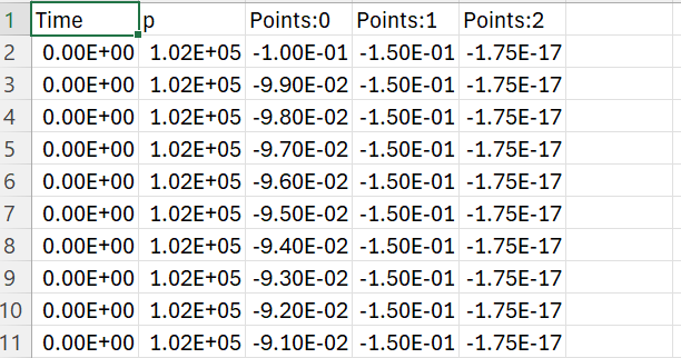
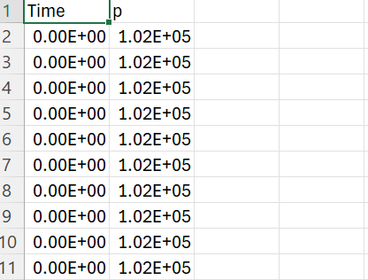
I have my simulation data (i.e., pressure data) in 2D slices over time (.vtk files). I loaded my data in Paraview and reduced the domain as necessary. As my grid was unstructured and I needed a uniform grid, I used Resample to Image. However, once I saved my data in .csv, it just saved the time and pressure. I need to save the point0 (x) and point1 (y). Is there any way to do it? Please let me know.
For example, this is what it is currently saving.
but I need to save it like this