Hello, I have 2 image data datasets that have identical extents, ranges, origins, and thus identical cell and point counts with one scalar field each. I essentially want to merge the scalars so that I have one dataset with 2 scalar fields.
I replicated my problem using the wavelet. I made one dataset by creating the wavelet with all defaults and saving it. Then I added 100 to the RTData, passed arrays to give me only the Result and saved that. Both as VTI files. The information tab looks good, except both indicate there is an “Undefined number of points”
If I group datasets, both RTData and Result show up as partial.
If I append datasets ( i get an unstructured grid) I lose both fields.
If I group datasets then clean to grid i still have twice the points/cells.
I know I could write some code to merge the data sets, but is there a way in the GUI to merge them?
thanks,
–John.
Hi John, you can try the AppendAttributes filter.
Taken from the filter’s help:
The Append Attributes filter takes multiple input data sets with the same geometry and merges their point and cell attributes to produce a single output containing all the point and cell attributes of the inputs
Here is the pipeline of your example:
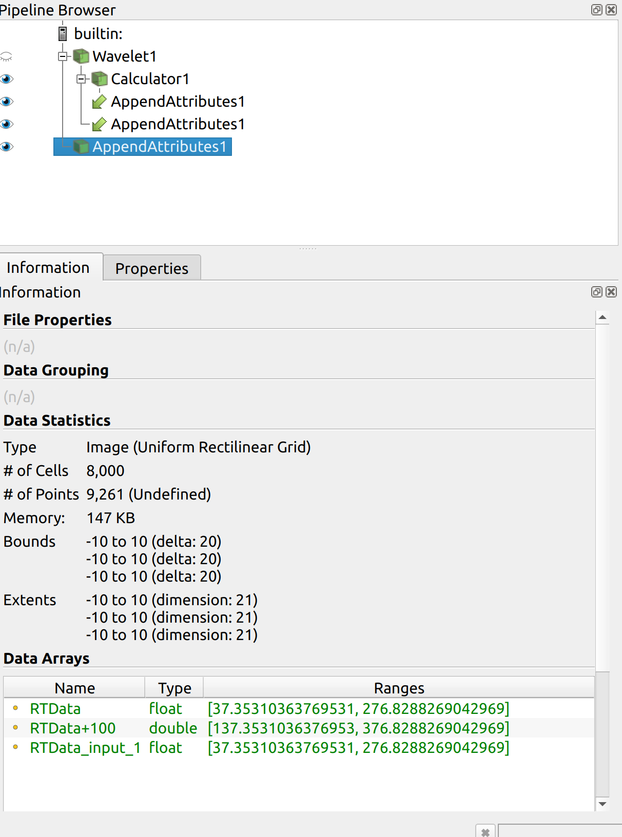
Notice that the the type (Image), number of cells, points, bounds etc. matches the original Wavelet.
Awesome, thanks for the response, that looks like that is exactly what I’m looking for. I think the name threw me off …
Sorry, I can’t reproduce this pipeline - Calculator is not callable before data files (in the pipelines it is called immediately after Wavelet). Thank you!
please open your own topic.