Hi,
I have a topography surface with hilly parts and buildings. I would like to get a contour plot for a variable over 2m height across the whole domain. i.e. an elevated 3D surface parallel to the ground condition. The slice filter cut the model at a constant elevation throughout which cuts through in some parts. Was wondering if there is any filter that I can use for this purpose? Thanks beforehand for any tip.
Thanks for getting back to me, Mathieu,
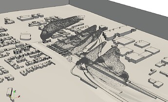
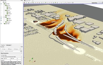
I’m trying to quantify the pollutant emissions outside a tunnel. The procedure asks for a contour plot 2m above ground level but near the portal is not a uniform flat ground but bumpy. In post processing data in the slice filter as you know we can only use plane orientation (in my case being Z) and corrdinate of the centre of the slice which I only give one Z value at its centre. This will make a cut at that elevation. So if the ground let’s say in 25m away bumps up, this slice will cut through it. Was wondering if there is any other feature in the Paraview that I can get the data parallel to the ground surface on a curtain height? Not sure the images I attached were loaded, but you this shows the plume of a pollutant out of a tunnel portal. the second image shows a slice set at Z=2m (since the roof of the portal is Z=0. As you can see (and expected for slice feature) this is not following the ground topology. I would like to get the data at 2m above ground which its surface is not fully flat and is changing.
If you can compute the elevation in the data you can just slice with scalars, this should be pretty simple.
You also may want to read this series of blog from Marco Miani:

