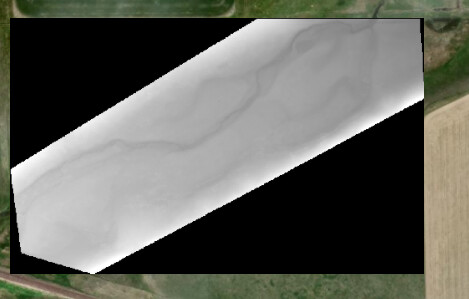
New to paraview and I am attempting to create a 3D model of DEM data I have worked up from ARC Pro. When inserting the .tif file it automates a background that autopopulates an elevation of 0
This then impacts the visual representation of the data in paraview as the scale is way off and does not actually display the proper values. Is there a way to remove this background with the tiff or adjust the coloring so it accurately reflects the DEM data?
I have been using the GDAL Raster reader so it is georeferenced, unsure how to interpret the data with proper elevations using tiff reader. I am attempting to visualize the data in a 3D model to incorporate electrical resistivity data profiles with the image.
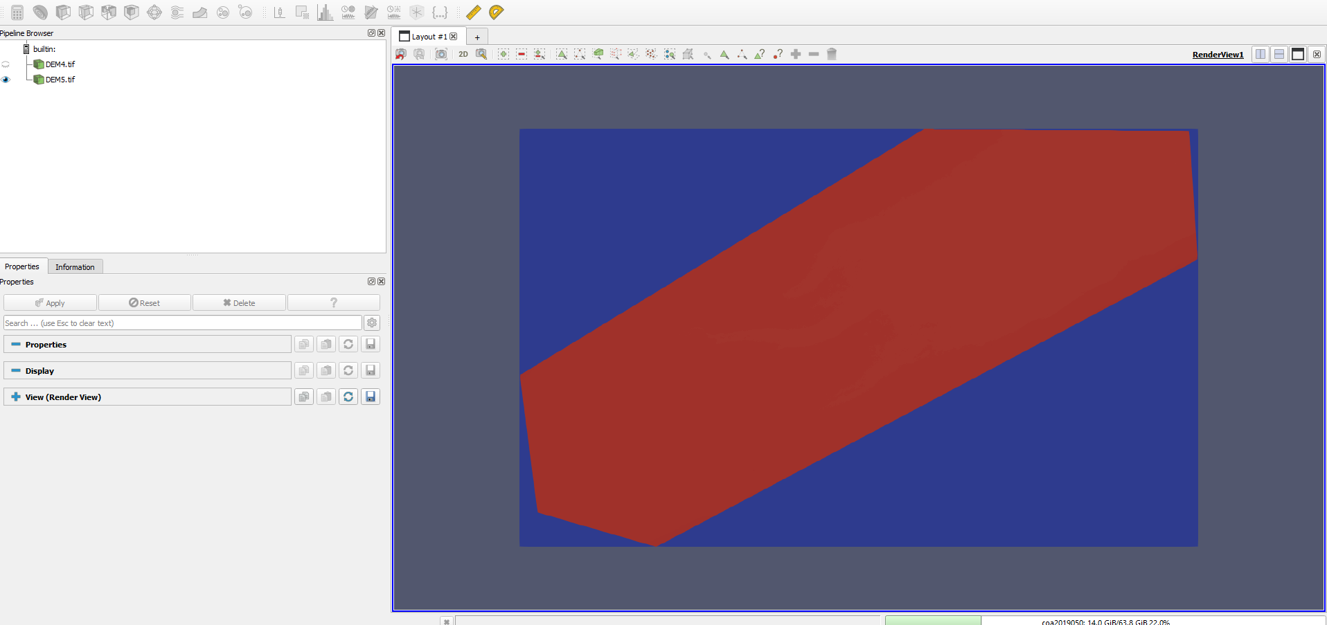
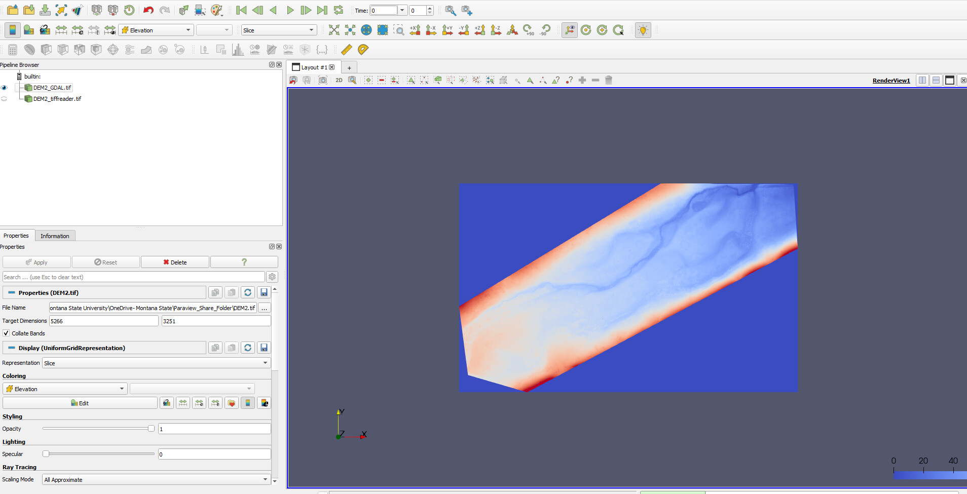
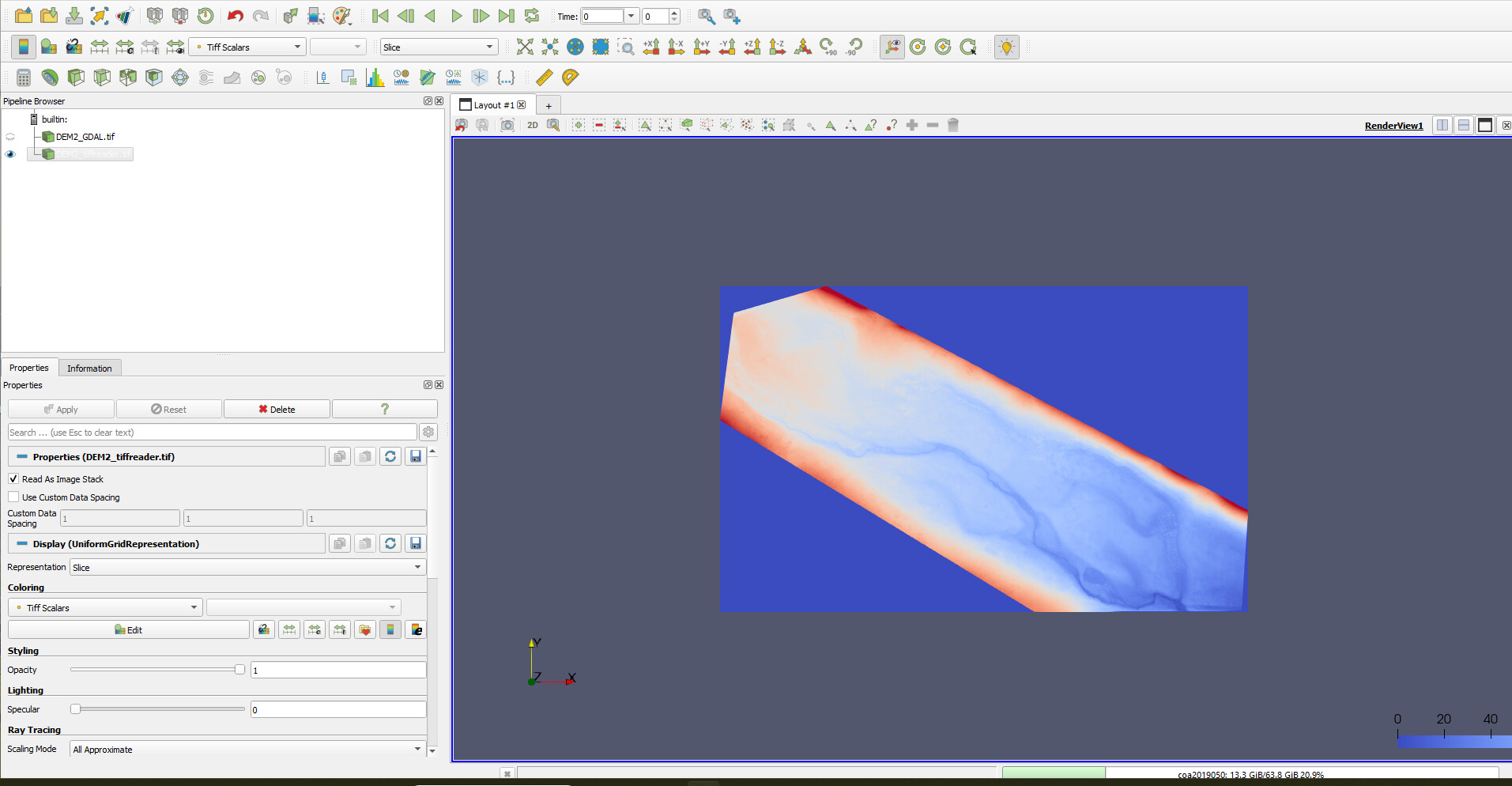
Alright, so I have been able to upload the .tiff to paraview by exporting a rendered version so elevation data is set as values ranging from 0-255. However, when loading the data into paraview using tiff reader the image is flipped upside down compared to the standard file. When I load the .tiff file into paraview using GDAL the image is properly displayed, but then cannot be shown in 3D imaging without the warp by scalar filter option. Attached are images of the data reading it using GDAL: