Hi all,
I have two csv files. One contains data for only one z plane and the other contains data for 41 z planes. I am using TableToStructureGrid Filter to get the domain from CSV file.
I also checked the number of rows. The first CSV file has 67312 rows while the other has 67312 * 41 = 2759792 rows. I have also arranged the rows by ‘y’ and then ‘z’ for the 3D CSV file. Still, I am getting the following results:( Pics attached)
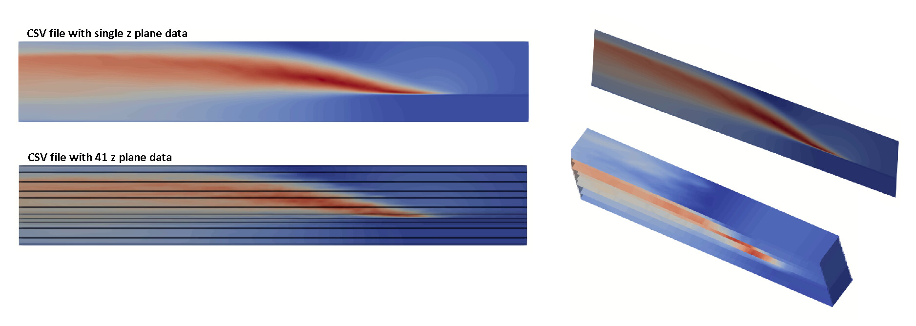
Could you please help me in figuring out why those horizontal black lines occur for the 3D csv files?
Thank you