ParaView
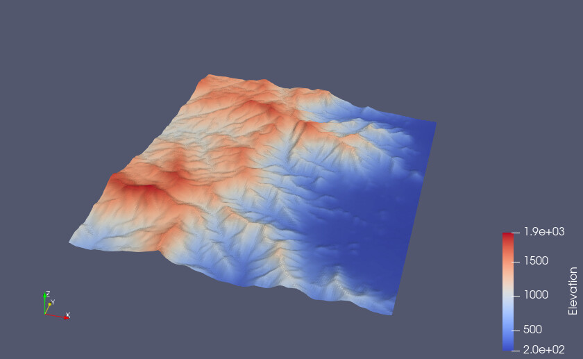
Visualization of Digital elevation model (.tiff file)with x,y and z axis in 3D view.
ParaView Support
mwestphal
(Mathieu Westphal (Kitware))
January 15, 2025, 12:46pm
6
Add a
CellDataToPointData
first:
image
840×517 48.7 KB
show post in topic